
This post may contain affiliate links where we earn from qualifying purchases from referring you to our favorite products and brands. As an amazon associate, we earn from qualifying purchases. Find out more in our disclosure.
If you’re a cyclist looking for a challenge, Alto de Letras should be near the top of your list. As a climb with nearly 13,000 feet elevation gain and more than 50 miles to the top, Alto de Letras is one of the most challenging cycling routes in the world.
As you start biking Alto de Letras, you’ll start riding in a tropical paradise, and end in a cold and wet environment above the clouds. Along the way you’ll see waterfalls, steep cliffs, many exotic birds, and the scenery the entire time is absolutely breathtaking. We’re here to walk you through the challenges of Alto de Letras, and why it’s considered one of the best Colombian Cycling routes.
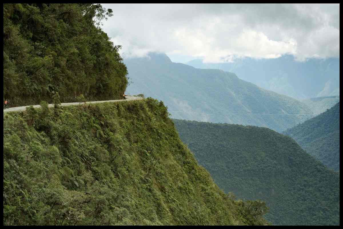
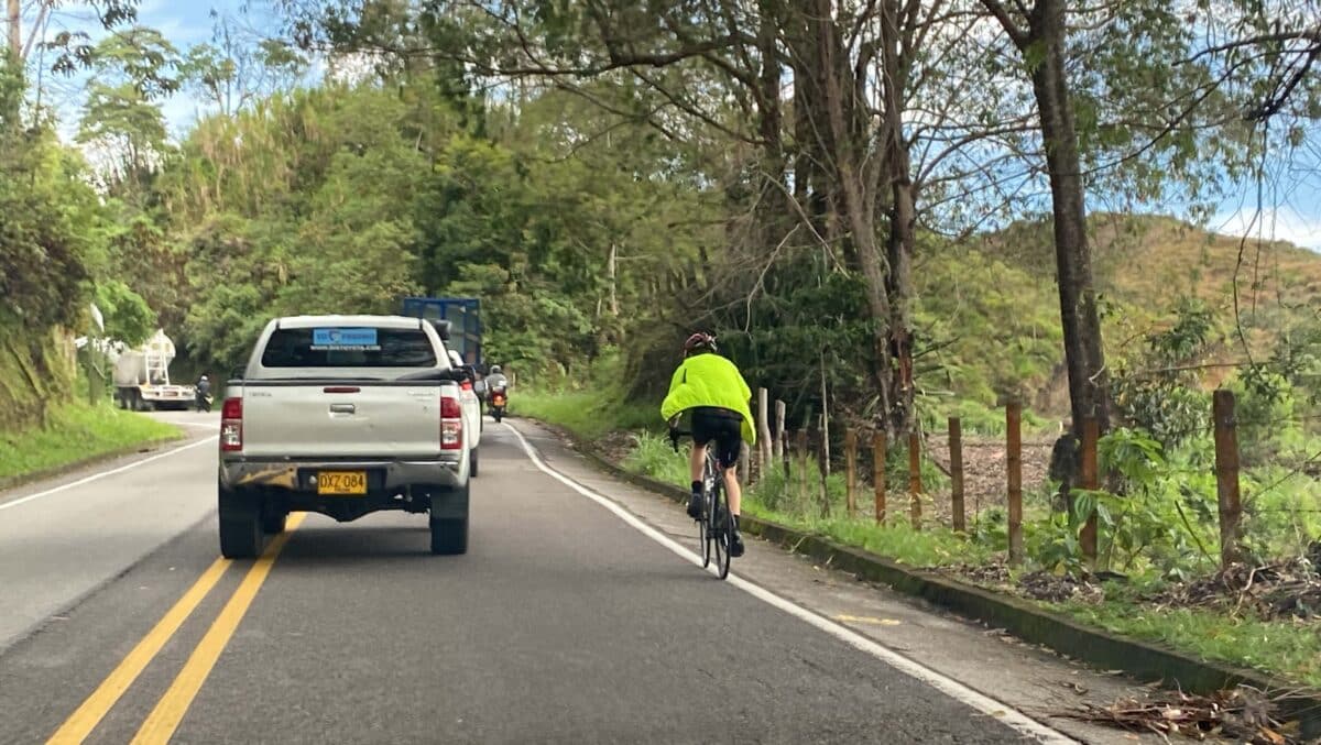
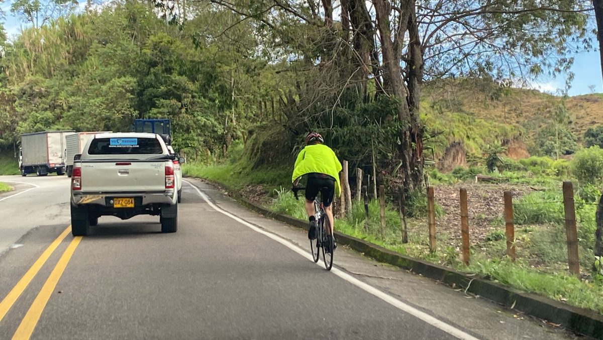
It’s not surprising that Columbia would have such an extreme climb. With no shortage of mountains and hills, it had some of the fastest cyclists in the world, including Egan Bernal, who won the Tour de France back in 2019. Cycling in Columbia has become so accepted that roads in major cities will close certain days of the week so that cyclists can be safe from cars while riding. Sadly, Alto de Letras is not one of those roads, and the shoulder is very small so you need to ride in the road, but the local drivers are very aware of bikers attempting the climb.
While Alto de Letras is not the world’s longest climb, it definitely comes close, officially the 3rd longest, although signs all over the climb will tell you that it’s number one. Even at number three though, this memorable road climb is well known and is a serious accomplishment for any rider who manages to summit.
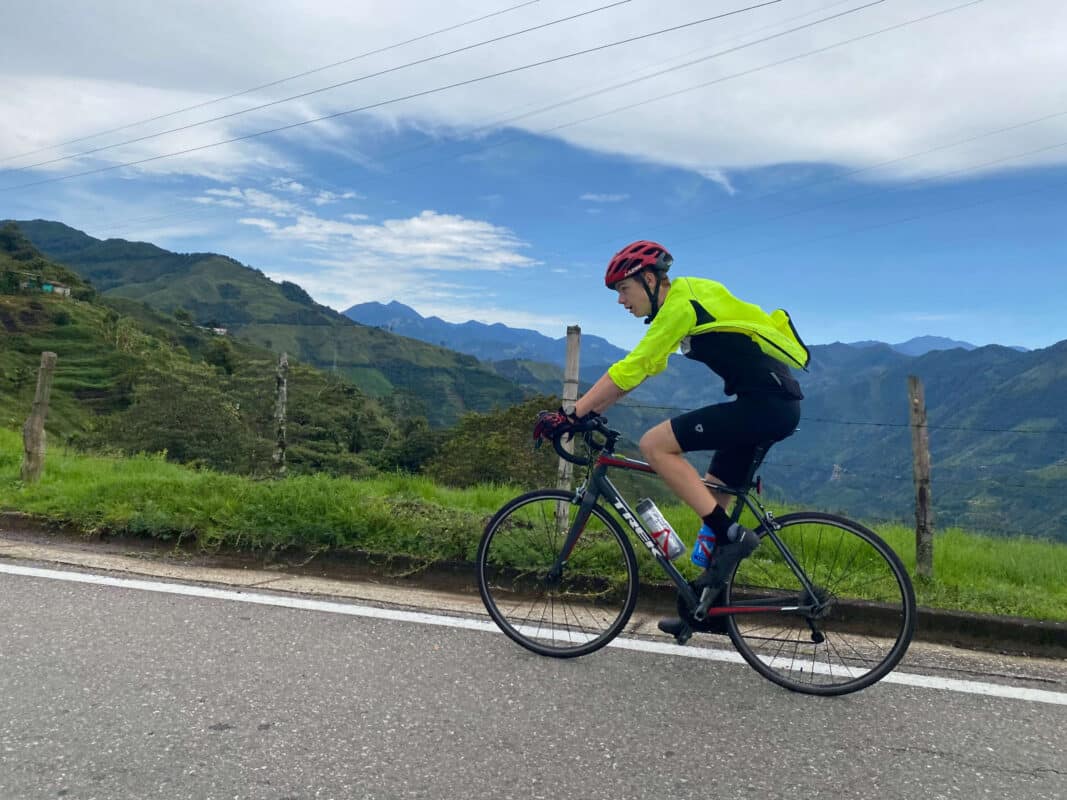
This article was written by Cam Averett, my 16-year-old son who trained and rode this ride during our families 2 month stay in Colombia. Cam has ridden over 15,000 miles as a teen, and is a Utah NICA State Mountain Bike Championship Winner. Read more about some of our favorite adventures in Colombia here.
Preparing to ride Alto de Letras

Essential Gear for Biking Alto de Letras
While attempting a climb like this, there are several things you can’t forget. First, and most importantly, a bike. You’ll want to make sure that your bike is running well, as mechanical issues on the climb can become a big problem if you’re not car supported. Make sure to bring a few spare tubes, an extra chain, multitool, and spare brake pads if you intend to ride down. You’ll also need some reflective clothing, a helmet, and maybe a jacket depending on the weather. You’ll need some lights, both in front and behind your bike, to make sure that cars can see you. Snacks are another necessity. You’ll want tons of things to eat to keep you going. We’d recommend having something to eat for every 20-40 minutes that you’re on the road, so bring more food than you think you’re going to eat. There aren’t many good places to stop and have lunch, or buy just about anything, so be well prepared. You’ll also want a lot of water, since this climb usually takes people about 6 hours, but some signs are posted about where you can buy an extra gatorade.
Fitness requirements for riding Alto de Letras

Before attempting this climb, you’re going to want to be sure you can handle it. First, you’ll need to have some longer rides anywhere from 50-100 miles under your belt. During these rides practice maintaining a high power at low cadence for long periods of time, to prepare yourself for the demands of the climb. You’ll need to make sure you can ride upwards of 8 hours before starting this ride, because it could take you even longer. As long as you feel comfortable pedaling for long periods of time, you’ll be just fine. Another thing to look out for is the elevation. Letras starts at less than 2,000 feet, but towards the end it’s more than 12,000, which makes about the last half of this climb the hardest. Make sure to bring some medication to help with altitude sickness, and practice cycling in a close area with higher elevation, like Medellin or Manizales.
Local Weather Conditions and Best Time to Ride

Weather is something you will need to be aware of. As of April 2023, Nevado del Ruiz, a nearby volcano is active and spewing ash miles into the air, a potential danger to anyone thinking about riding in this area. Make sure to check the status of the volcano before riding, and consider bringing a mask to prevent from inhaling ash if conditions are unsafe. As far as weather goes, you should avoid rain, but it can be unpredictable in these areas. Make sure you bring proper clothing for the current temperature throughout the climb, accounting for the fact that it could be very cold near the top. Generally, you should avoid riding weekends because of traffic, but you should check the current local traffic patterns to see if there’s something to worry about.
The Climb up Alto de Letras: Everything You Should Know
Overview of Alto de Letras
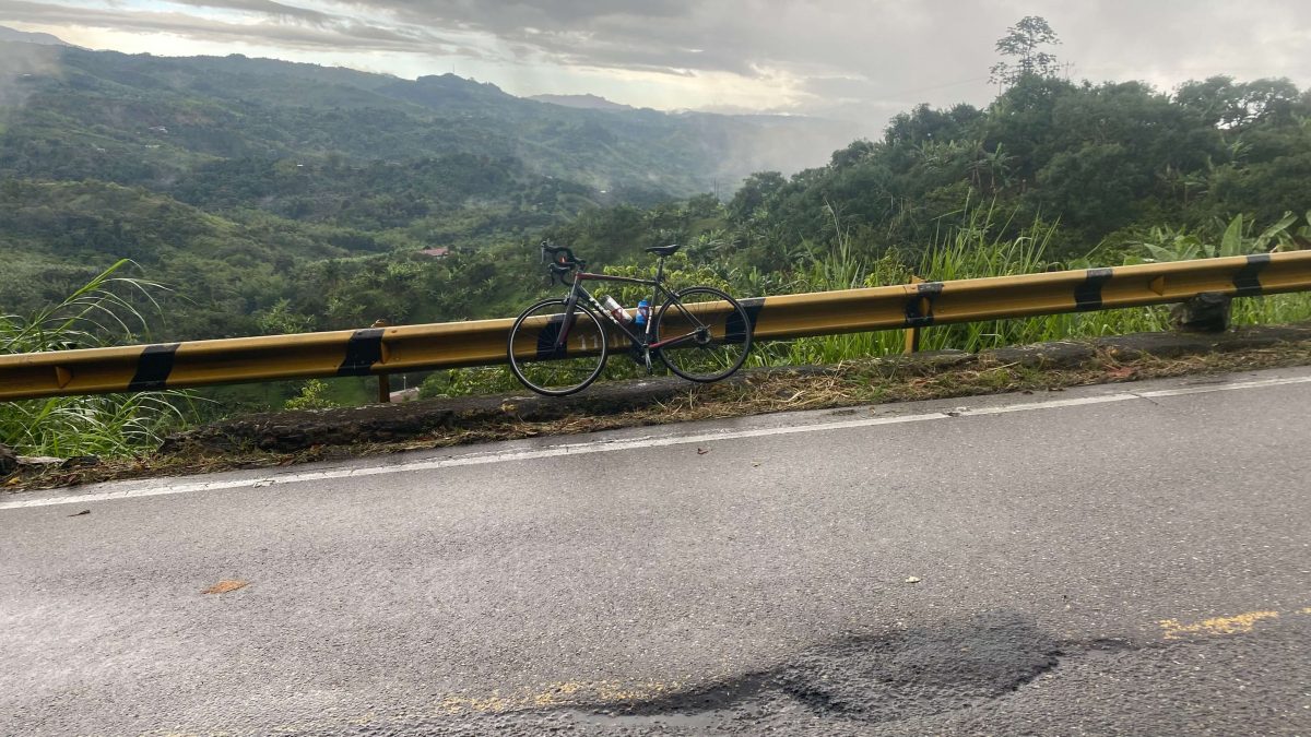
As I mentioned above, this climb is just over 50 miles (81 km) long. It starts in the town of Marquita and goes up and up, climbing about 12,749 feet (3885 meters) and passing through a town called Fresno on the way. The average grade top to bottom is about 4%, but when you take out the descents, the actual climbing sections are a brutal 8% grade. This whole time there is no real shoulder, so make sure traffic can see you since you’ll need to ride in the road. The climb itself ends in a valley near the top of some mountains, but most people continue down the other side to Manizales, which puts you around 70 miles.
Starting in Mariquita
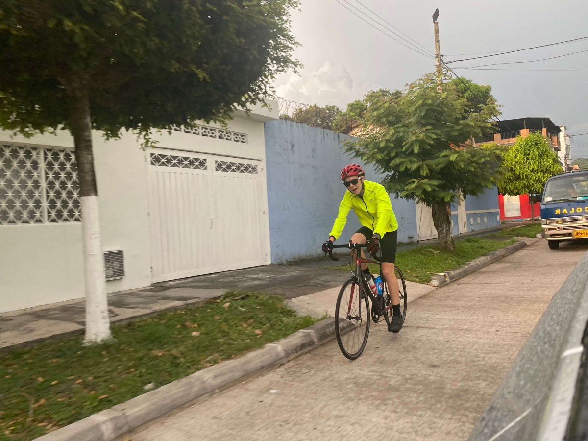
Mariquita is the small town that Alto de Letras goes through before the actual climbing starts. Mariquita is well known for having the oldest Roman Catholic chapel in Columbia in the Plaza de Mariquita, so if you’re spending some time there it’s worth stopping to see it. After you’ve seen everything in town, you’ll want to start riding early enough in the morning when it’s not hot or sunny yet. The road itself for Alto de Letras is Carrera 7, and it goes right through the middle of town. Go north up it, and you’ll start winding down to a riverbed. Once all the way down, you’ll suddenly start climbing. Let the fun begin!
The Initial Segment
After first starting the climb, you’ll be faced with some of the steepest roads in the entire climb. It’s in a thick jungle, and will slowly open up as the climb continues. At about mile 3 you get your first break and it flattens out in an area where the trees start to open up a bit more. It continues like this for about two miles, but enjoy them because you won’t be getting many more sections to rest. Soon after you start climbing again you’ll pass through your first layer of clouds, allowing you to see how high some of the mountains around you really are. You’ll get another short descent around mile 9, but soak it up, as there won’t be another until about mile 30. As you keep going up you’ll get to the town of Fresno at about mile 15. The town itself is impressively big for being in such a remote area, and there’s a few gas stations that are perfect for grabbing something to drink or eat.
The second segment

Though the miles go slow on a climb like this, by this point you’ve made some real progress. Here things will start to open up even more, and you’ll get about 10 miles on ridgelines and mountainsides. The grade here is pretty constant, until mile 25 where you take a sharp right in the town of Padua, and enter a steeper section until you have a short descent at mile 30. During this time you’ll start to notice the vegetation changing. Even though you started in a dense jungle, up here is a pine forest growing on very steep mountainsides. You’ll stay on the side of a mountain until around mile 37 where you’ll go down to a saddle between two mountains and cross to the mountain on the other side.
The Last Few Miles

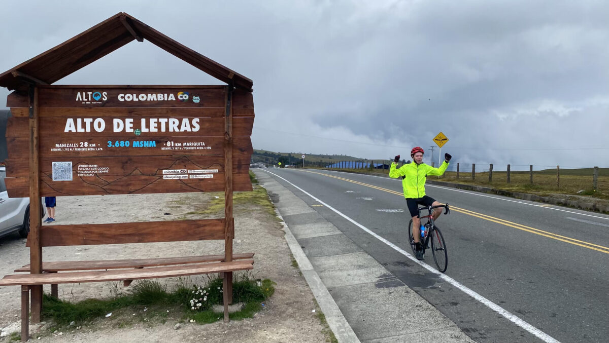
This might be the toughest part yet. At this point you know that you’re close, and the altitude starts to settle in. As you get higher up, you pass through the second layer of clouds at about mile 40. About here you’ll start to notice waterfalls that pass under the road every mile or so, and the road will start to wind more than ever, causing a very inconsistent grade. At about mile 45 things change again and you enter an area with less large plants and a whole lot of small, more colorful ones that grow on rock cliffs walls to your right. You know you’re almost there when you get your last small descent at about mile 47. To show that you’re close, a sign saying “The Longest Climb on Earth” stands off to your side. The last few miles are easy grade wise, but the altitude is killer up here and breathing becomes a struggle. Then, finally, you’ll see a sign down the road.
Wrapping up and going down

Off to the side of the road there is a sign in a parking lot with a bench for you to take a picture and mark your achievement. Up here there sadly aren’t any restaurants or anything to celebrate with, but if you keep going down the road you can start to go down the other side to the city of Manizales and grab something to eat there. It’s about 20 miles downhill you get there, but at this point, you’ve earned all the free miles there are on the way down. Going down the other side is about as steep as the rest of the climb up, and since there isn’t a real shoulder the safest thing to do is just to ride with traffic, since this road is a whole lot more windy than the climb up.
Tips for Riding Alto de Letras
Acclimatize yourself
If you aren’t used to high altitudes, you’re going to want to spend some time in a higher up area. The climb starts at a very low altitude, so spending a few days in Mariquita before the climb isn’t a good idea. However, if you go north Medellin has some great cycling opportunities at higher altitude, or Manizales is super cyclist friendly and sits at an elevation of more than 7,000 feet. If you aren’t acclimatized when you start, you’re really going to want some altitude sickness pills. It will help you to breathe easier and stay steady even if your body isn’t used to the lack of oxygen.
Pacing and nutrition
The best thing you can do to pace yourself is to start slow. If you aren’t going for a faster time, just take it easy on your legs and get into a good rhythm you can hang on to. Don’t expect to come cruising up this thing in like 3 hours though, as it takes most people closer to 6 or 7. Stay aware of your heart rate and aim to stay in zone one or two for the whole ride.
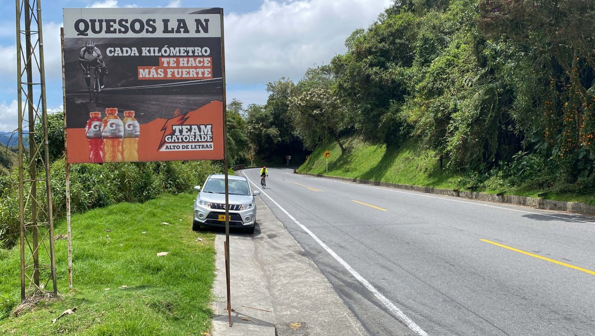
As far as nutrition goes, you’ll want a ton of food. Shoot to drink a lot too. The best plan is to be eating something a few times an hour so your body doesn’t run out of fuel. You’ll be able to find places on the side of the road that sell Gatorades every few miles, so look out for the signs they post. You also might have to force yourself to eat. Sometimes your body will reject more food, even though it needs more fuel, so make sure you are eating as much as you need to.
Conclusion
In conclusion, tackling the Alto de Letras bike route in Colombia is a monumental challenge that offers stunning scenery, a test of physical and mental endurance, and the chance to immerse yourself in Colombian cycling culture. With proper preparation, essential gear, and knowledge of the route, you can conquer this awe-inspiring climb and create lasting memories. Embrace the journey, pace yourself, and celebrate your accomplishment at the summit. Alto de Letras awaits, inviting you to conquer its steep slopes and experience the thrill of reaching new heights as a cyclist.


